Monday- Sunday, August 11-17, 2014
Isle of Dough, Ballyliffin, Donegal County, Ireland
WOW! What terrific
views looking out the windows of our abode here in BallyMcGeehan, the name
of our home on Dough Island.


The house was built to be a B and B, but our
hosts had decided that running a B and B would tie them down too much. They
too have the traveling itch as Larry and I do. Built seven years ago, the home
has three bedrooms with en suite and a well designed open floor plan of family
room, dining and kitchen. There is another room for a formal dining or living
area that they have not decided how to use.


There are additional three en suite bedrooms upstairs. Larry could have fun chasing me around this house! HA! It is a lovely home with tall windows of sweeping views of the water.

Margaret, Gerry's wife, is a retired art teacher and she has many beautiful painting displaying her talent.
There are additional three en suite bedrooms upstairs. Larry could have fun chasing me around this house! HA! It is a lovely home with tall windows of sweeping views of the water.
After so
many days of driving and sightseeing, we decided to just relax and enjoy a
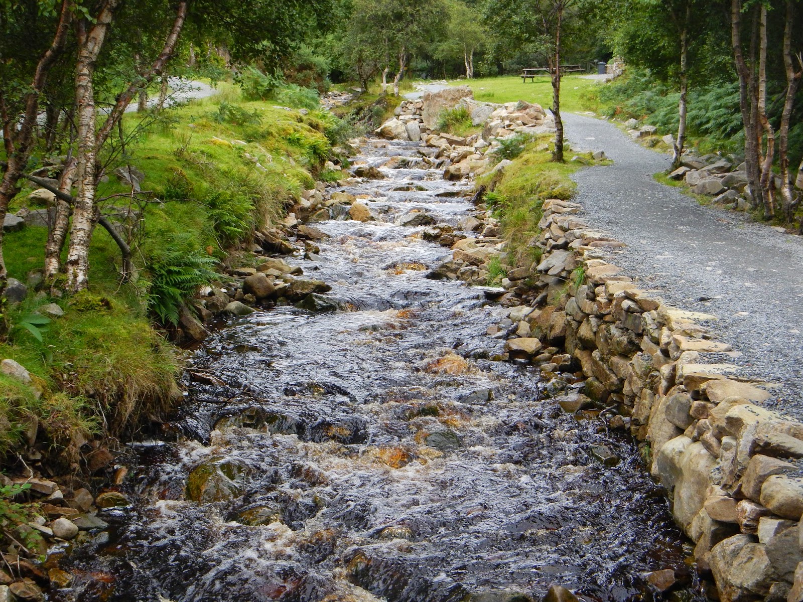
couple of quiet days. We took a great long walk along the waterside and up
several mountains and enjoyed so much gorgeous scenery right out our front
door.


The beach out our front door
Each area of our walk had a special stone with the family name giving the area their name.
Along our walk we saw many mounds of the peat bricks that the locals burn during the winter for heat.
It was probably the best two days to take off because it rained more than
we had seen the whole time we were in Ireland. It turned out to be two great
days of not getting in the car and just reading and enjoying some peaceful moments.
The people
of Ireland have been some of the friendliest on Earth. They always stop what they
are doing to have a chat. We have had many offers for tea and some who have
wanted to lead us to the right road. Many encounters have been quite memorable.
Eating out
in Ireland is very pricey. We had read that it would be wise to pack picnic
lunches due to the remote areas not having a lot of places to eat. There are very
few fast food places….the variety of pubs make up for the lack of eateries.
Festivals
are plentiful in Ireland. Each little area seems to have something going on to
bring people out and about during the summer. We missed the Festival Roses of Tralee by just a few days in Tralee. When
we arrived in Ballyliffen a local music Festival of Clonmany was coming to an
end. The streets were closed off and for 10 days, talented bands took center stage
to perform. We saw cars parked all over the sides of these narrow roads and crowded
streets as we came into the area on Sunday. This is a very popular festival that
has been going on for close to forty years. Many of the same Irish return every
year. Larry and I attended the final night of the festival on Monday which was
a talent show. We especially enjoyed one contestant who was trying to sound a lot like
Johnny Cash.
Wednesday
was a marvelous day! It was raining cats and dogs but by the time we left to find Gerry’s other home. …4 kilometers away…the rain had stopped. We
pulled into his driveway and found Gerry ready to go. We continued on toward
Malin Head, the most Northern point in
Ireland. From Ballyliffin we scurried down R238 to
Carndonaghn on to R242 into Malin, winner of being the Tidy Town for three
years.


On we journeyed down a narrow twisted road to Ballygorman and on to the very spot of the most Northern point of Ireland, Malin Head.


We hiked down the path taking in so many fabulous view points out to the Atlantic Ocean…so natural…so rugged…so wonderful! Larry was experiencing a photographers dream and was snapping away. We took a rigorous hike here with the wind blowing very steady. It was exhilarating.


 A lookout that dates back to Napolean's time... also used during WW I AND II


On we journeyed down a narrow twisted road to Ballygorman and on to the very spot of the most Northern point of Ireland, Malin Head.
We hiked down the path taking in so many fabulous view points out to the Atlantic Ocean…so natural…so rugged…so wonderful! Larry was experiencing a photographers dream and was snapping away. We took a rigorous hike here with the wind blowing very steady. It was exhilarating.


Gerry was so kind to take us down several back roads that led to many marvelous views. After a while we headed back the way we came… there was no other way off the remote peninsula.

We stopped in Carndonagh to see one of the oldest stone crosses in Ireland. Dating back to the 7th century, it had been taken from its original position and placed under roof for preservation. Some of the carvings of human figures and interlacing lines could still be seen. It was unusual to touch something so old.

Next Gerry
guided us through Ballyliffinn to Clonmany to Dunaff. We stopped to get shots
of an old church, several beautiful homes, and just some downright gorgeous scenery.

 We passed a whole field of the sweetest donkeys.
We had a little picnic lunch on one of the most scenic hill sides along the way.
We had a little picnic lunch on one of the most scenic hill sides along the way.


The Gap of Mamore
Irish heather was blooming across the mountains. Heather is to Ireland just as tulips are to Holland. How did we get so lucky to be in Ireland while the heather was at its peak!


We passed over the Urris Hills through
the Gap of Mamore to Fort Dunree, one of four government posts that the British
guarded during World War I and II. We
walked about enjoying the history of the area.

Fort Dunree

Yes, it was breezy and cool, but refreshing enough to walk about.

Crossing the draw bridge into the fort!

View from the drawbridge!
On we drove
to where we took a hike by a brackish stream that lead us to fantastic Glenevin Waterfall.
What a beautiful two mile walk especially since it ended with ice cream at a
restaurant/café/B and B.

Entrance into Glenevin Waterfall


A little snack at the Glen House after walking to the Glenevin Falls
Gerry
directed us to an unspoiled beach on Tullagh Bay. It was just on the
other side of the mountain where we had walked on Monday. The tide was out and
the beach was enormously wide.

Gerry took
us to a castle ruins near BallyMcGeehan. It was the
final stop of the day and a marvelous place to capture a few more snapshot of the seascapes with the sun
starting to sink.


Larry and I
dropped Gerry off at his home around 5:30. We returned to BallyMcGeehan to get on flip flops and head down to the waters edge at low tide
to hunt for some Irish mussels. No luck with finding any mussels but we
enjoyed a walk around the mud flat area and came back with some succulent
oysters.
What a
day….just about as fabulous as one can be!
Thursday we left the house at 8:00 AM heading for
Moville and Greencastle to catch a ferry to Northern Ireland…the English side.
It was a glorious day with lots of sunshine.


The ferry was a quick fifteen minutes to Magilligan Point.

Now in Northern Ireland, we were on British soil.
Here we drove the car out on Benone Beach.
Here we drove the car out on Benone Beach.


and then stopped to view the Mussenden Temple in Down.


British flags flapped everywhere. Following the Causeway Coastal Route we got a little lost going into Coleraine. A sweet tourist guide pointed us in the right direction through Bushmills past the ruins of the Dunluce and Dunseverick Castles.
Upon arriving at one of our destinations, the Giant’s Causeway at noon, Ireland’s only UNESCO World Heritage Site and the 8th Natural Wonder of the World, we hiked down the mountainside and out to unbelievable views of the North Atlantic.


The
strangeness of this place and the bizarre regularity of its basalt columns have
made the Giant’s Causeway the subject of numerous legends. The most popular
legend tells of how the giant, Finn MacCool laid the causeway to provide a path
across the sea to his lady love who lived on the Island of Staffa in Scotland
where similar columns are found.


We have seen various estimates of basalt
columns existing….from 14,000 to 43,000. Most columns are hexagonal but some
have four, five, eight or even ten sides. Millions of years of geological activity
can be witnessed in the eroded cliffs flanking the Causeway. We enjoyed
climbing all over the stones and catching the ocean breezes while viewing the
wonder of the column formations.


After a
quick lunch we drove on to our second destination of the day, the Carrick-A-Rede Rope Bridge. I thought, “Oh,
this has to be a tourist trap.” But the bridge was traditionally erected by
salmon fisherman back in the 1700’s. We paid our 5.3 British Sterling and began a fabulous walk....Oh the scenery was stupendous!


 The Rope Swing Bridge connected these isles to the mainland
 Can you spot the line of people waiting their turn to cross?
After an exhilarating coastal walk we traversed a 30 meter deep and 20 meter wide chasm by rope bridge capturing views of Rathlin Island. Having crossed one of these in New Zealand that was three times as long, we said, "No Sweat!" It was more fun watching the kids that attempted.

Our car headed back down the scenic Causeway Coastal Highway. It is interesting that going down the same road the opposite way affords totally new views of the ocean and the rolling hills. We arrived a little early for the 5:15pm ferry so we scurried into the convenient restaurant for a couple of ice teas. We looked at the sweeping views of the Foyle while enjoying our liquid refreshment. Larry enjoyed talking with a couple of German motorcyclist who were touring Ireland for the next two weeks. We are hoping that they have sunny skies for their tour.

The ride across the Foyle was smooth and relaxing. We arrived back at Ballymcgeehan around 6:30 for a night of peaceful pleasure on the Isle of Dough.


After an exhilarating coastal walk we traversed a 30 meter deep and 20 meter wide chasm by rope bridge capturing views of Rathlin Island. Having crossed one of these in New Zealand that was three times as long, we said, "No Sweat!" It was more fun watching the kids that attempted.
The views walking to and from the bridge were stunning!
Our car headed back down the scenic Causeway Coastal Highway. It is interesting that going down the same road the opposite way affords totally new views of the ocean and the rolling hills. We arrived a little early for the 5:15pm ferry so we scurried into the convenient restaurant for a couple of ice teas. We looked at the sweeping views of the Foyle while enjoying our liquid refreshment. Larry enjoyed talking with a couple of German motorcyclist who were touring Ireland for the next two weeks. We are hoping that they have sunny skies for their tour.
The ride across the Foyle was smooth and relaxing. We arrived back at Ballymcgeehan around 6:30 for a night of peaceful pleasure on the Isle of Dough.
No comments:
Post a Comment